Zapote sits on the boundary where Las Piñas meets Bacoor, and the bridge here was the site of two battles — one against Spain, one against the United States. Today it is a dense commercial junction on the coastal road south, and traffic through it is constant.
1 place · from ₱50,000
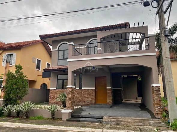
Every listing shows when it was last checked — taken places come down.
Not what you were looking for? Tell us and we will find it.
Want us to find a place in Zapote?
Tell us your terms and we will look and get back to you — including areas not listed here yet.
By property type
Buildings in this area
Nearby areas
Jeepney and bus routes
Routes whose line passes within 800 m of this area’s point. Distance is measured, not estimated.
- Alabang-Baclaran via Zapote, San Dionisio12 mAlso passes San Dionisio · Almanza · Talon
- Alabang–Zapote12 mAlso passes Alabang · Almanza · Talon
- Almanza–Baclaran12 mAlso passes San Dionisio · Talon · Pamplona
- Baclaran–Moonwalk12 mAlso passes San Dionisio · Talon · Pamplona
- Diego Cera Avenue–Merville12 mAlso passes Sucat · Merville · Pamplona
- Alabang–Baclaran via Zapote, San Dionisio13 mAlso passes San Dionisio · Almanza · Talon
- Baclaran–Moonwalk via Quirino13 mAlso passes San Dionisio · Talon · Pamplona
- Jeepney Route: Binakayan - Zapote Loop13 mAlso passes Talaba · Bacoor Poblacion · Pamplona
- Route 23: Alabang–Plaza Lawton via Alabang-Zapote57 mAlso passes Malate · Almanza · Talon
- Minibus: Cavite City → Zapote155 mAlso passes Talaba · Pamplona
- Minibus: Zapote → Cavite City155 mAlso passes Talaba · Pamplona
- Bacoor (NoMo)–Makati CBD P2P493 mAlso passes Makati CBD · San Lorenzo · Talaba
Routes and distances from OpenStreetMap contributors (ODbL). Route names are kept as they are called locally.
About Zapote
Barangay Zapote, Las Piñas, Metro Manila
- Budget
How far from the main hubs
- NAIA T1 — 7.3 km in a straight line
- NAIA T3 — 7.7 km in a straight line
- Makati · Ayala — 11.6 km in a straight line
- BGC — 12.7 km in a straight line
Straight-line distance, not travel time — in Metro Manila 3 km can take 40 minutes. Coordinates from OpenStreetMap.
Landmarks within walking range
- Zapote Terminal (terminal) — 0.2 km in a straight line
- New Las Piñas City Public Market (market) — 0.2 km in a straight line
- Las Piñas Plaza Commercial Center (mall) — 0.2 km in a straight line
- Pamplona Hospital & Medical Center (hospital) — 0.3 km in a straight line
- Zapote Public Market (market) — 0.5 km in a straight line
- Bacoor Public Market (market) — 0.5 km in a straight line
Within 1.5 km, straight-line distance. Places from OpenStreetMap contributors (ODbL).
Earthquake hazards at this spot
- Tsunami inundation
- 4 to < 5 meters
From one point at the centre of the area, not the whole area. Wording and grades are PHIVOLCS’ own. Acknowledge Philippine Institute of Volcanology and Seismology.
Schools & hospitals nearby
- St. Dominic College of Asia
- Divine Light Academy