Forbes Park is the oldest and most exclusive of the Makati villages, laid out in the 1940s on land that had been the Ayala hacienda. Lots are large, the streets are private and gated, and houses here rarely appear on the open rental market at all.
1 place · from ₱600,000
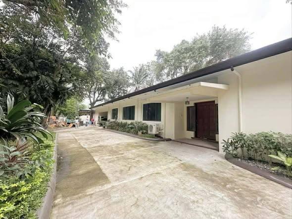
Every listing shows when it was last checked — taken places come down.
Not what you were looking for? Tell us and we will find it.
Want us to find a place in Forbes Park?
Tell us your terms and we will look and get back to you — including areas not listed here yet.
By property type
Nearby areas
Jeepney and bus routes
Routes whose line passes within 800 m of this area’s point. Distance is measured, not estimated.
- BGC Bus LX: Lower West Express11 mAlso passes Fort Bonifacio · BGC
- BGC Bus NR: Night Route (EDSA-Ayala → University Parkway)11 mAlso passes BGC · Fort Bonifacio
- BGC Bus NR: Night Route (EDSA-Ayala → University Parkway: Sunday 6am-6pm)11 mAlso passes Fort Bonifacio · BGC
- BGC Bus NX: North Express11 mAlso passes Fort Bonifacio · BGC
- BGC Bus UX: Upper West Express11 m
- BGC Bus W: West Route11 mAlso passes Fort Bonifacio · BGC
- BGC East Express Loop11 mAlso passes Fort Bonifacio · BGC
- BGC Bus AX: Ayala Avenue Express637 mAlso passes Legazpi Village · Salcedo Village · Pio del Pilar
- Route 1: EDSA Carousel679 mAlso passes Magallanes · Boni · Guadalupe
- Route 42: Ayala–Malanday via MacArthur Highway706 mAlso passes Marulas · Karuhatan · Malinta
- Route 45: FTI–Navotas via Ayala706 mAlso passes Magallanes · Bel-Air · North Bay Boulevard
- Taguig City–Makati CBD P2P706 mAlso passes Legazpi Village · Pinagsama · EMBO
Routes and distances from OpenStreetMap contributors (ODbL). Route names are kept as they are called locally.
About Forbes Park
Barangay Forbes Park, Makati, Metro Manila
- Families
- Quiet
- Expats
How far from the main hubs
- BGC — 1.3 km in a straight line
- Makati · Ayala — 1.5 km in a straight line
- NAIA T3 — 3.9 km in a straight line
- NAIA T1 — 4.6 km in a straight line
- Ortigas — 5.2 km in a straight line
Straight-line distance, not travel time — in Metro Manila 3 km can take 40 minutes. Coordinates from OpenStreetMap.
Landmarks within walking range
- San Antonio Plaza Arcade (mall) — 0.1 km in a straight line
- BGC - Ayala Terminal (terminal) — 0.7 km in a straight line
- Buendia (station) — 0.8 km in a straight line
- Ayala (station) — 0.8 km in a straight line
- One Ayala (terminal) — 0.9 km in a straight line
- The SM Store (mall) — 0.9 km in a straight line
Within 1.5 km, straight-line distance. Places from OpenStreetMap contributors (ODbL).
Earthquake hazards at this spot
- Nearest active fault
- West Valley Fault — about 3.0 km away
From one point at the centre of the area, not the whole area. Wording and grades are PHIVOLCS’ own. Acknowledge Philippine Institute of Volcanology and Seismology.